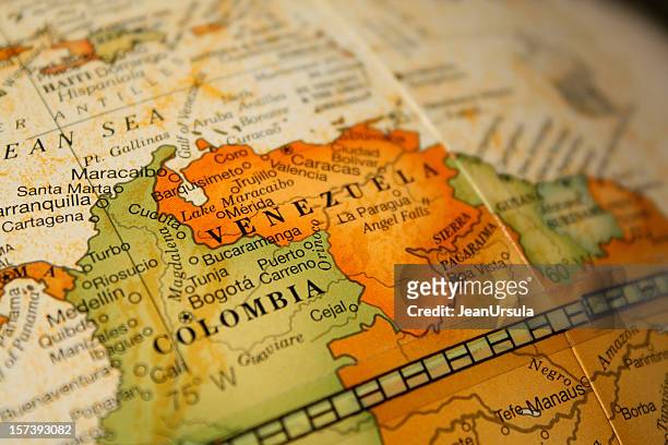
map of colombia and venezuela - map of haiti and dominican republic stock pictures, royalty-free photos & imagesMap of Colombia and Venezuela
map of central america - infographic set - map of haiti and dominican republic stock illustrationsMap of Central America - Infographic Set
map of central america - illustration - map of haiti and dominican republic stock illustrationsMap of Central America - illustration
central america and the caribbean high detailed blue map with regions - map of haiti and dominican republic stock illustrationsCentral America and the Caribbean High detailed Blue map with Regions
map of central america. vector illustration with infographic icons - map of haiti and dominican republic stock illustrationsMap of Central America. Vector Illustration with infographic icons
map of central america - illustration - map of haiti and dominican republic stock illustrationsMap of Central America - illustration
cartoon map of dominica - map of haiti and dominican republic stock illustrationsCartoon map of Dominica
Haiti and Dominican Republic, true colour satellite image. This image was compiled from data acquired by LANDSAT 5 & 7 satellites., Haiti And...Haiti (With Mask And Border) And Dominican Republic, True Colour Satellite Image
cartoon map of haiti and hispaniolan trogon - map of haiti and dominican republic stock illustrationsCartoon Map of Haiti and Hispaniolan trogon
hispaniola map folded, isolated on white background - map of haiti and dominican republic stock illustrationsHispaniola map folded, isolated on white background
Haiti and Dominican Republic, true colour satellite image with border. This image was compiled from data acquired by LANDSAT 5 & 7 satellites., Haiti...Haiti And Dominican Republic, True Colour Satellite Image With Border
Cartography, 16th century. Map of the Island of Hispaniola , Puerto Rico and part of the Antilles. From Abraham Ortelius , Theatrum Orbis Terrarum,...Map of Island of Hispaniola, Santo Domingo, Puerto Rico and part of Antilles from Abraham Ortelius, 1528-1598, Theatrum Orbis Terrarum, 1570
map of central america - map of haiti and dominican republic stock illustrationsMap of Central America
dominican republic map on old paper - vintage texture - map of haiti and dominican republic stock illustrationsDominican Republic Map on old paper - vintage texture
Nearly every country in the Americas has seen a population boom in the last three decades. Some have doubled in size. Data Source: UN's 2024 World...Mapped: How Populations Have Changed in the Americas (1990-2023)
central america map. vector colored map of latin america - map of haiti and dominican republic stock illustrationsCentral America Map. Vector colored map of Latin America
political map of north america in vector format - map of haiti and dominican republic stock illustrationspolitical map of north america in vector format
stippled hispaniola map - stippling art - dotwork - dotted style - map of haiti and dominican republic stock illustrationsStippled Hispaniola map - Stippling Art - Dotwork - Dotted style
hispaniola map with location pins isolated on white background - map of haiti and dominican republic stock illustrationsHispaniola Map with location pins isolated on white Background
Thomson Map of Porto Rico, Virgin Islands, Haiti, Dominican Republic, John Thomson, 1777 - 1840, was a Scottish cartographer from Edinburgh, UKThomson Map of Porto Rico
dominican republic - red grunge rubber stamp with name and map - map of haiti and dominican republic stock illustrationsDominican Republic - Red grunge rubber stamp with name and map
vintage map of central america. vector illustration - map of haiti and dominican republic stock illustrationsVintage Map of Central America. Vector Illustration
vintage map of the west india islands 1860s - map of haiti and dominican republic stock illustrationsVintage map of the West India Islands 1860s
central america travel map, kingston ,san salvador ,port-au prince ,santo domingo ,san jose' ,panama city ,guatemala city ,tegucigalpa ,belmopan ,managua ,havana ,mexico city ,nassau - map of haiti and dominican republic stock illustrationsCentral America Travel Map, Kingston ,San Salvador ,Port-au Prince ,Santo Domingo ,San Jose' ,Panama City ,Guatemala City ,Tegucigalpa ,Belmopan ,Managua ,Havana ,Mexico City ,Nassau
antique map of cuba and antilles - map of haiti and dominican republic stock illustrationsAntique map of Cuba and Antilles
central america - infographic map - illustration - map of haiti and dominican republic stock illustrationsCentral America - Infographic map - illustration
map of central america - map of haiti and dominican republic stock illustrationsMap of Central America
a map of the american continent in shades of blue - map of haiti and dominican republic stock illustrationsA map of the American continent in shades of blue
central america map. vector colored map of latin america - map of haiti and dominican republic stock illustrationsCentral America Map. Vector colored map of Latin America
mexico, central america and the west indies antique victorian engraved colored map, 1899 - map of haiti and dominican republic stock illustrationsMexico, Central America and the West Indies Antique Victorian Engraved Colored Map, 1899
north america political antique victorian engraved colored map, 1899 - map of haiti and dominican republic stock illustrationsNorth America Political Antique Victorian Engraved Colored Map, 1899
map of north america continent - illustration - map of haiti and dominican republic stock illustrationsMap of North America Continent - Illustration
central america map. vector colored map of latin america - map of haiti and dominican republic stock illustrationsCentral America Map. Vector colored map of Latin America
north america map on blue background, long shadow, flat design - map of haiti and dominican republic stock illustrationsNorth America Map on Blue Background, Long Shadow, Flat Design
map of central america - map of haiti and dominican republic stock illustrationsMap of Central America
Map of the Atlantic Ocean, showing the southeast United States, Cuba, Haiti, Jamaica, the Dominican Republic and Puerto Rico, with the Bermuda...Map of Bermuda Triangle
vintage map of central america - map of haiti and dominican republic stock illustrationsVintage Map of Central America
eastern canada, u.s. and atlantic ocean - map of haiti and dominican republic stock pictures, royalty-free photos & imagesEastern Canada, U.S. and Atlantic Ocean
north america political antique victorian engraved colored map, 1899 - map of haiti and dominican republic stock illustrationsNorth America Political Antique Victorian Engraved Colored Map, 1899
Cowperthwait Map of Cuba and West Indies - Geographicus - WestIndies. 1850. Hand colored map is a lithographic engraving of the West Indies dating to...Cowperthwait Map of Cuba and West Indies
Stockdale Map of Hispaniola or Santo Domingo, West Indies, Haiti, Dominican Republic.1800 Stockdale Map of Hispaniola or Santo Domingo
antique map of west indies and central america, 19th century - map of haiti and dominican republic stock illustrationsAntique map of West Indies and Central America, 19th Century
The island of Hispaniola, with the two spanish colonies Spagnola and Isabella, founded by Columbus in the first and in the second voyage to the New...HISPANIOLA OR THE NEW WORLD
central america map. vector illustration - map of haiti and dominican republic stock illustrationsCentral America Map. Vector Illustration
Thomson Map of Porto Rico, Virgin Islands, Haiti, Dominican Republic, John Thomson, 1777 - 1840, was a Scottish cartographer from Edinburgh, UK.1815 Thomson Map of Porto Rico
Cartography, 16th century. Map of Island of Hispaniola . From the Codex Raro.Map of Island of Hispaniola, Haiti and Dominican Republic from the Codex Raro
map of north america with flags against white background - map of haiti and dominican republic stock illustrationsmap of North America with flags against white background
dominican republic - blue sticker and stamp with name and map - map of haiti and dominican republic stock illustrationsDominican Republic - Blue sticker and stamp with name and map
colored map of central america - map of haiti and dominican republic stock illustrationsColored Map of Central America
blue map of north america with flag against white background - map of haiti and dominican republic stock illustrationsBlue map of North America with flag against white background
blue map of americas with paper cut effect - map of haiti and dominican republic stock illustrationsBlue map of Americas with paper cut effect
central america map. vector colored map of latin america - map of haiti and dominican republic stock illustrationsCentral America Map. Vector colored map of Latin America
central america - infographic map - illustration - map of haiti and dominican republic stock illustrationsCentral America - infographic map - Illustration