Aerial view of Sandbanks Peninsula and Poole Harbour. - stock photo
Sandbanks was reported to have the fourth highest land value by area in the world. Brownsea Island is visible in Poole Harbour.

Get this image in a variety of framing options at Photos.com.
PURCHASE A LICENCE
All Royalty-Free licences include global use rights, comprehensive protection, and simple pricing with volume discounts available
335.00 €
EUR
Getty ImagesAerial View Of Sandbanks Peninsula And Poole Harbour High-Res Stock Photo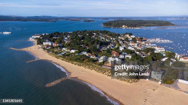 Download premium, authentic Aerial view of Sandbanks Peninsula and Poole Harbour. stock photos from Getty Images. Explore similar high-resolution stock photos in our expansive visual catalogue.Product #:1345301645
Download premium, authentic Aerial view of Sandbanks Peninsula and Poole Harbour. stock photos from Getty Images. Explore similar high-resolution stock photos in our expansive visual catalogue.Product #:1345301645335€50€
Getty Images
In stockDETAILS
Credit:
Creative #:
1345301645
Licence type:
Collection:
Photodisc
Max file size:
5680 x 3195 px (48.09 x 27.05 cm) - 300 dpi - 14 MB
Upload date:
Location:
Bournemouth, Dorset, United Kingdom
Release info:
No release required
Categories:
- Sandbanks - Poole Harbour,
- Dorset - England,
- Beach,
- Brownsea Island,
- Aerial View,
- Bournemouth - England,
- Summer,
- Coastline,
- Colour Image,
- Drone Point of View,
- England,
- English Channel,
- Ferry,
- Harbour,
- Horizontal,
- Land,
- Luxury,
- Making Money,
- No People,
- Outdoors,
- Passenger Craft,
- Peninsula,
- Photography,
- Real Estate,
- Sea,
- Staycation,
- Sunlight,
- UK,
- Vacations,
- Water,
- Wealth,
- Yachting,