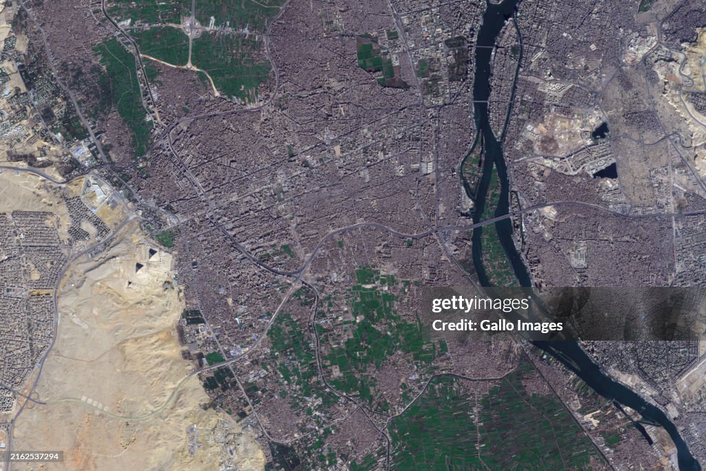
Satellite Imagery Of The Pyramids Of Giza
CAIRO, EGYPT - 13 JANUARY 2024: A satellite view of the Pyramids of Giza, situated southwest of Cairo along the Nile River. Recent research suggests that Egypt’s pyramids were likely built near a now-abandoned branch of the Nile River, which once facilitated the transportation of materials during construction. (Photo by Gallo Images/Orbital Horizon/Copernicus Sentinel Data 2024)

PURCHASE A LICENCE
How can I use this image?
335.00 €
EUR
Getty ImagesSatellite Imagery Of The Pyramids Of Giza, News Photo Satellite Imagery Of The Pyramids Of Giza Get premium, high resolution news photos at Getty ImagesProduct #:2162537294
 Satellite Imagery Of The Pyramids Of Giza Get premium, high resolution news photos at Getty ImagesProduct #:2162537294
475€150€
Getty Images
In stockDETAILS
Restrictions:
Contact your local office for all commercial or promotional uses.SOUTH AFRICA OUT
Credit:
Editorial #:
2162537294
Collection:
Gallo Images
Date created:
13 January, 2024
Upload date:
Licence type:
Release info:
Not released. More information
Source:
Gallo Images Editorial
Object name:
pyramidsegyptsatelliteview
Max file size:
1800 x 1200 px (15.24 x 10.16 cm) - 300 dpi - 2 MB