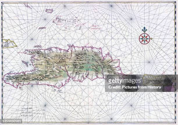
Nautical chart of Haiti, the Dominican Republic and Puerto Rico.
A 1639 nautical map of Hispaniola (center-left), the most populous island in the Americas, and Puerto Rico (right). The name originally given by Christopher Columbus, who founded the first European colonies in the New World here during his first two voyages, was La Isla Espanola ('the Spanish island'), which was shortened to Espanola and then Latinised to Hispaniola. (Photo by: Pictures From History/Universal Images Group via Getty Images)

PURCHASE A LICENCE
How can I use this image?
335.00 €
EUR
Getty ImagesNautical chart of Haiti, the Dominican Republic and Puerto Rico., News Photo Nautical chart of Haiti, the Dominican Republic and Puerto Rico. Get premium, high resolution news photos at Getty ImagesProduct #:1354450581
 Nautical chart of Haiti, the Dominican Republic and Puerto Rico. Get premium, high resolution news photos at Getty ImagesProduct #:1354450581
475€150€
Getty Images
In stockPlease note: images depicting historical events may contain themes, or have descriptions, that do not reflect current understanding. They are provided in a historical context. Learn more.
DETAILS
Restrictions:
Contact your local office for all commercial or promotional uses.
Credit:
Editorial #:
1354450581
Collection:
Universal Images Group
Date created:
01 January, 1754
Upload date:
Licence type:
Release info:
Not released. More information
Source:
Universal Images Group Editorial
Object name:
1060_05_cpa0002591
Max file size:
5000 x 3523 px (42.33 x 29.83 cm) - 300 dpi - 15 MB