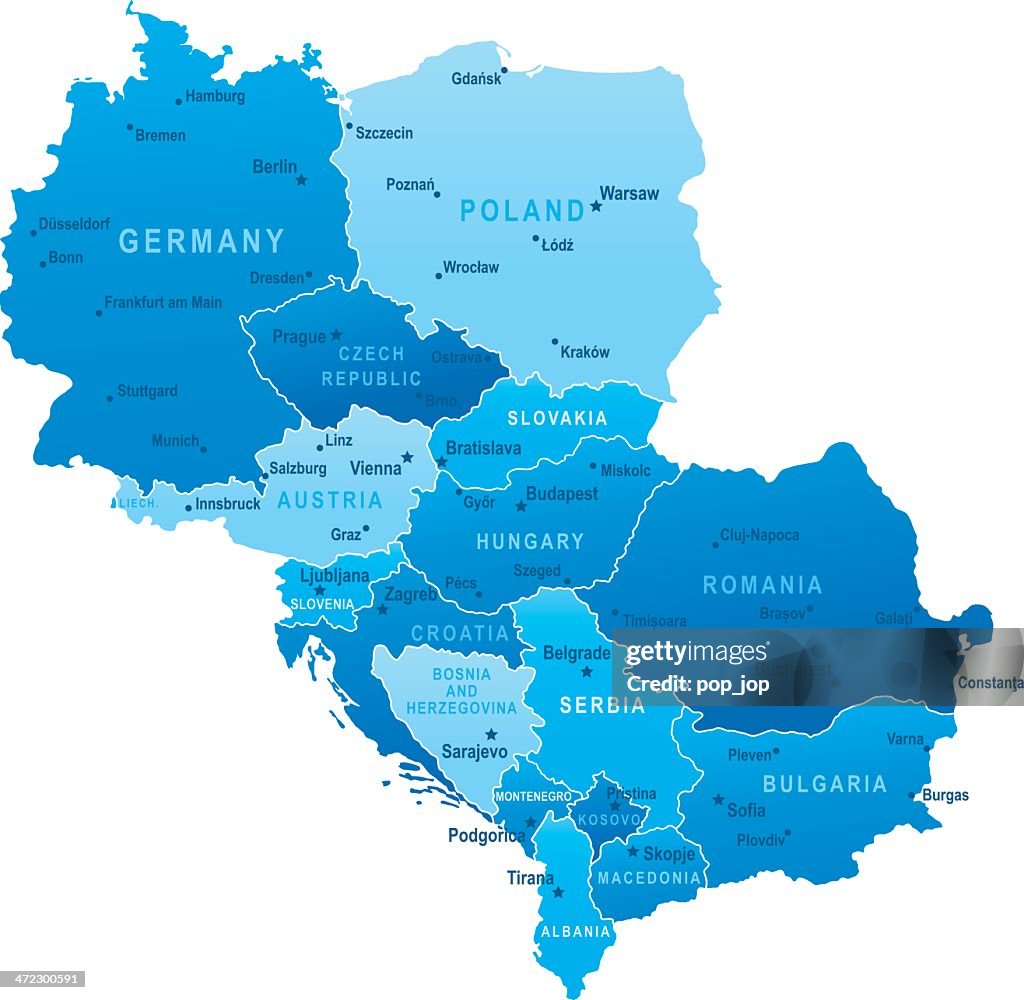
Map of Central Europe - states and cities - stock illustration
Highly detailed vector map of Central Europe with states, capitals and big cities

Get this image in a variety of framing options at Photos.com.
PURCHASE A LICENCE
All Royalty-Free licences include global use rights, comprehensive protection, and simple pricing with volume discounts available
335.00 €
EUR
Getty ImagesMap Of Central Europe States And Cities High-Res Vector Graphic Download premium, authentic Map of Central Europe - states and cities stock illustrations from Getty Images. Explore similar high-resolution stock illustrations in our expansive visual catalogue.Product #:472300591
 Download premium, authentic Map of Central Europe - states and cities stock illustrations from Getty Images. Explore similar high-resolution stock illustrations in our expansive visual catalogue.Product #:472300591
335€50€
Getty Images
In stockDETAILS
Credit:
Creative #:
472300591
Licence type:
Collection:
DigitalVision Vectors
Max file size:
4167 x 4067 px (35.28 x 34.43 cm) - 300 dpi - 2 MB
Upload date:
Release info:
No release required
Categories:
- Map,
- Serbia,
- Croatia,
- Czech Republic,
- Poland,
- Kosovo,
- Europe,
- Hungary,
- Montenegro,
- Prague,
- Slovakia,
- Vector,
- Austria,
- Belgrade - Serbia,
- Bosnia and Herzegovina,
- Germany,
- Slovenia,
- Vienna - Austria,
- Albania,
- Berlin,
- Blue,
- Bratislava,
- Budapest,
- Bulgaria,
- Capital Cities,
- Cartography,
- Central Europe,
- City,
- Geographical Locations,
- Illustration,
- Land,
- Ljubljana,
- Macedonia - Greece,
- Podgorica,
- Pristina,
- Romania,
- Sarajevo,
- Separation,
- Skopje,
- Sofia,
- Symbol,
- Tirana,
- Travel,
- Warsaw,
- Zagreb,