Kyoto, Japan Vector Map - stock illustration
Poster Style Topographic / Road map of Kyoto, Japan 京都 Original map data is open data via © OpenStreetMap contributors

Get this image in a variety of framing options at Photos.com.
PURCHASE A LICENCE
All Royalty-Free licences include global use rights, comprehensive protection, and simple pricing with volume discounts available
335.00 €
EUR
Getty ImagesKyoto Japan Vector Map High-Res Vector Graphic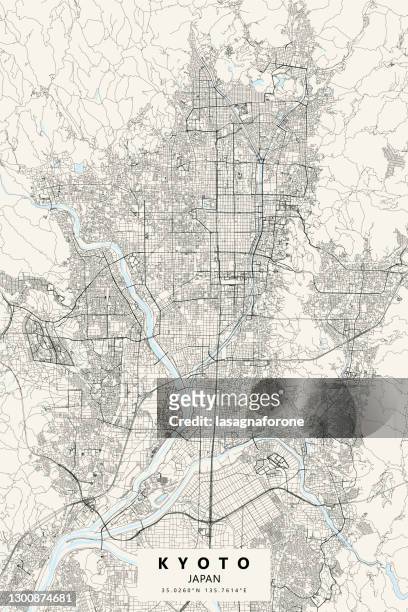 Download premium, authentic Kyoto, Japan Vector Map stock illustrations from Getty Images. Explore similar high-resolution stock illustrations in our expansive visual catalogue.Product #:1300874681
Download premium, authentic Kyoto, Japan Vector Map stock illustrations from Getty Images. Explore similar high-resolution stock illustrations in our expansive visual catalogue.Product #:1300874681335€50€
Getty Images
In stockDETAILS
Credit:
Creative #:
1300874681
Licence type:
Collection:
DigitalVision Vectors
Max file size:
3000 x 4500 px (25.40 x 38.10 cm) - 300 dpi - 21 MB
Upload date:
Location:
United States
Release info:
No release required
Categories:
- Kyoto City,
- Map,
- Kyoto Prefecture,
- Illustration,
- Japan,
- Street Map,
- Japanese Culture,
- Osaka City,
- Vector,
- Gion Matsuri,
- Nijo Castle,
- Inari Shrine,
- Kinkaku-ji Temple - Kyoto,
- Kyoto University,
- Aerial View,
- Arashiyama,
- Architecture,
- Backgrounds,
- Blueprint,
- Cartography,
- City,
- City Street,
- Colours,
- Downtown District,
- Fushimi Inari Shrine,
- Island,
- Japanese Castle,
- Japanese Food,
- Katsura,
- Kinki Region,
- Kyoto Gyoen,
- Kyoto Imperial Palace,
- Kyoto Protocol,
- Kyoto Station,
- Kyoto Tower,
- Longitude,
- No People,
- Outline,
- Physical Geography,
- Poster,
- Road,
- Street,
- Topographic Map,
- Topography,
- Tourism,
- Tourist,
- Travel,
- Travel Destinations,
- USA,
- Uji - Kyoto,
- Vacations,
- Vertical,