District of Columbia Area Map - stock illustration
A large map of the District of Columbia area, including main roads, parks, water and points of interest. All elements are on separate layers for easy changes or removal. Includes a CS5 file and an extra-large JPG so that you can crop in to the area you need. Also includes a version of only DC, without the surrounding states.

Get this image in a variety of framing options at Photos.com.
PURCHASE A LICENCE
All Royalty-Free licences include global use rights, comprehensive protection, and simple pricing with volume discounts available
335.00 €
EUR
Getty ImagesDistrict Of Columbia Area Map High-Res Vector Graphic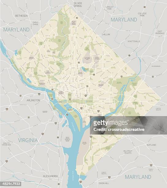 Download premium, authentic District of Columbia Area Map stock illustrations from Getty Images. Explore similar high-resolution stock illustrations in our expansive visual catalogue.Product #:482967933
Download premium, authentic District of Columbia Area Map stock illustrations from Getty Images. Explore similar high-resolution stock illustrations in our expansive visual catalogue.Product #:482967933335€50€
Getty Images
In stockDETAILS
Credit:
Creative #:
482967933
Licence type:
Collection:
DigitalVision Vectors
Max file size:
3909 x 4396 px (110.32 x 124.06 cm) - 90 dpi - 7 MB
Upload date:
Release info:
No release required
Categories: